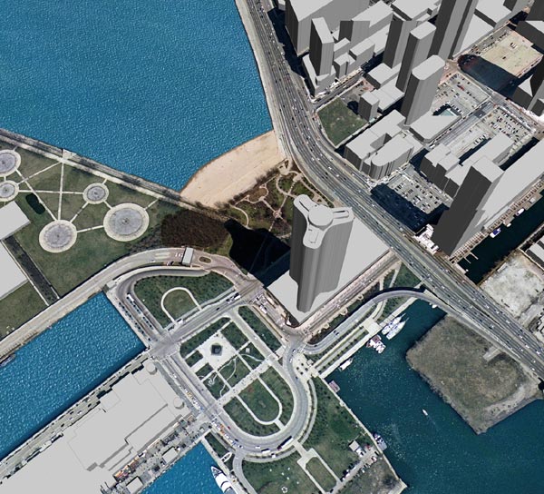
Google Earth a Disaster Management Tool

Disaster control experts are discovering Google Earth as a powerful tool in their work, according to a recent article in Spiegel Online.
Google Earth wasn't really intended for scientists. The Google search engine's extraordinary globe, which is made up of hundreds of thousands of satellite photos and aerial images, was initially meant as a game for virtual hobby pilots. Users discovered that it was fun to fly over their own homes, swing up into space and, within seconds, swoop back down into the depths of the Grand Canyon. But now the scientific community is discovering how useful the software is for their own work.
Homeland Security applications include:
* Critical infrastructure vulnerability assessment and protection
* First responder site familiarization and planning
* Pattern visualization of surveillance data
Google Earth solutions for homeland security include professional Google Earth Enterprise Solutions and Google Earth Pro.
When Hurricane Katrina hit the Gulf Coast almost a year ago, people across the country and around the world wondered how to help. Many donated money; others lent their homes to dislocated survivors. A group of Googlers lent their expertise by leveraging the power of Google technology.
Over several long nights, the teams from Google Earth and Google Maps created satellite imagery overlays of the devastation in the affected region, which showed more accurately the scope of the disaster.
Soon after, Google was told that rescue workers and the U.S. Air Force were using Google Earth to find people who were stranded.
And last week, Google received formal recognition from the National Geospatial-Intelligence Agency. Members of the NGA presented the "Hurricane Katrina Recognition Award" to the Google Earth team, as well as the Google Enterprise and Global Support groups, for their direct support during the Katrina disaster. [via]
0 Comments:
Post a Comment
<< Home